
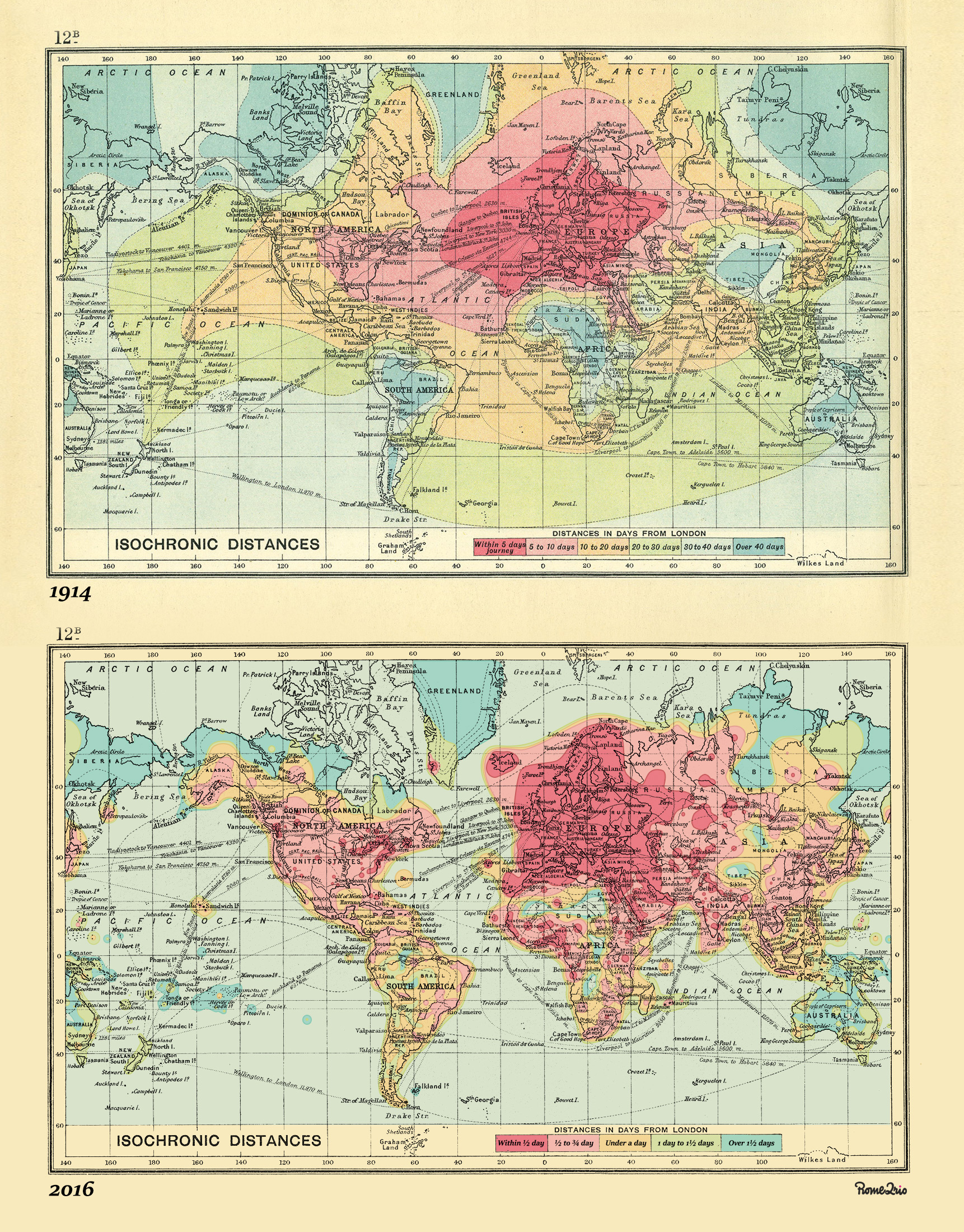
Some of you may have seen my December 2 post showing an “isochronic” map of the world. The map visualized the length of time it took to get from London to anywhere else in the world in 1914. More recently, the good folks at The Telegraph have updated the original 1914 map with 2016 data. To give just one example, it took five days to reach the East Coast of the United States in 1914. Today, it takes half-a-day.
To view the full size image, click here.
The first appeared in Cato At Liberty.